GPSMAP® 1022xsv
COMBINED CHARTPLOTTER 10″ colour touchscreen diplay and built-in sonar
Premium, combined GPS chartplotter for demanding fishermen and sailors. It offers a powerful, easy-to-read, ultra-high-resolution display and compact size.
Performance data:
| Display size |
8.8" x 4.9"; 10.1" diagonal (22.4 x 12.5 cm; 25.7 cm diagonal) |
| Power input | 10-32 Vdc |
| Display resolution | 1024 x 600 pixels |
| GPS | Yes |
| Physical dimensions | 12.5" x 7.3" x 2.7" (31.8 x 18.5 x 6.9 cm) |
| Receiver |
10 Hz |
| Degree of watertightness |
IPX7 |
| Weight |
4.1 lbs (1.85 kg) |
| Installation options | Bail, flat or flush (Garmin does not offer any hardware or accessories for a flat-mount installation. Professional tools and knowledge is required.) |
| Display type | WUXGA, IPS |
Option to add a switch to control electronic devices on board.
Chartplotter packed with features.
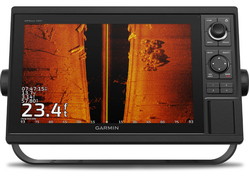
SONAR OPTION
Chartplotters feature an integrated CHIRP single channel sonar and CHIRP ClearVü™ and CHIRP SideVü™ scanning sonars with support for Panoptix™ and LiveScope™ sonars (select models only, probes sold separately).
INTEGRATED ANT® CONNECTION
With integrated ANT wireless technology, you can easily connect to compatible Garmin devices such as quatix® marine watches, gWind™ Wireless 2 sonars, GNX™ Wind marine instruments and wireless remotes.
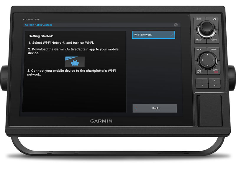
ACTIVECAPTAIN® MOBILE APP
Integrated Wi-Fi® technology offers access to the free, versatile ActiveCaptain app, allowing you to manage your boating environment from a compatible phone almost anywhere.
Navigate easily.
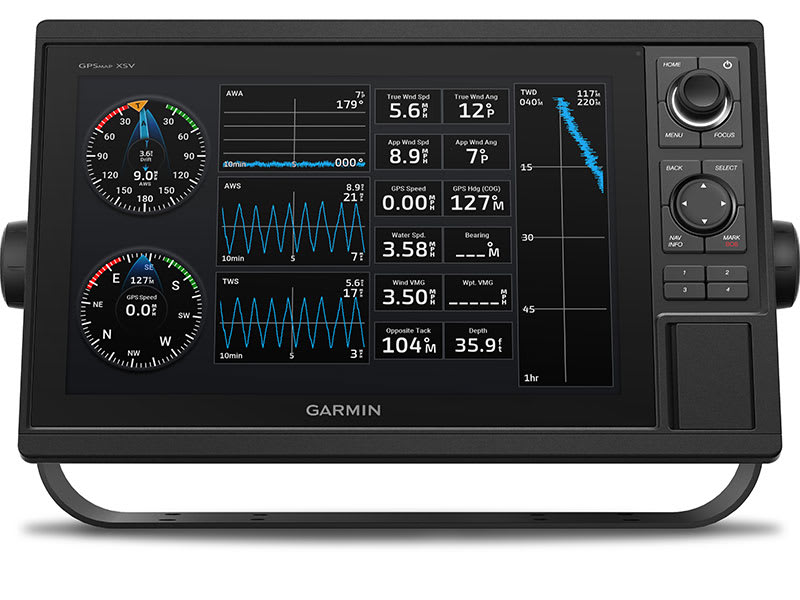
GARMIN SAILASSIST™ FEATURES
The ability to monitor important data fields to help you achieve maximum speed and efficiency. There are straight lines, current direction and speed, real and apparent wind data (transducer sold separately) and more.
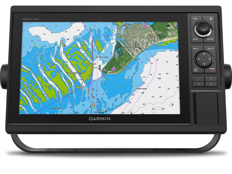
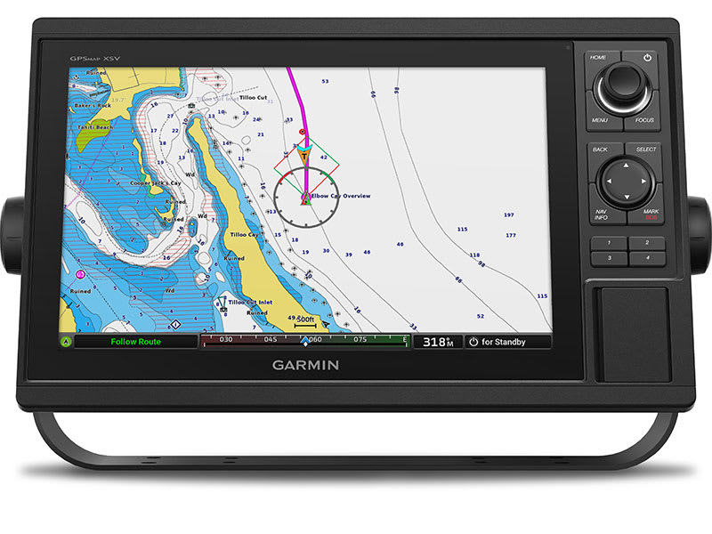
MAPS
Give your chartplotter a new look with optional Garmin Navionics+™ charts or premium Garmin Navionics Vision+™ cartography with integrated coastal and land charts, access to daily updates, Auto Guidance+™ technology1 and more.
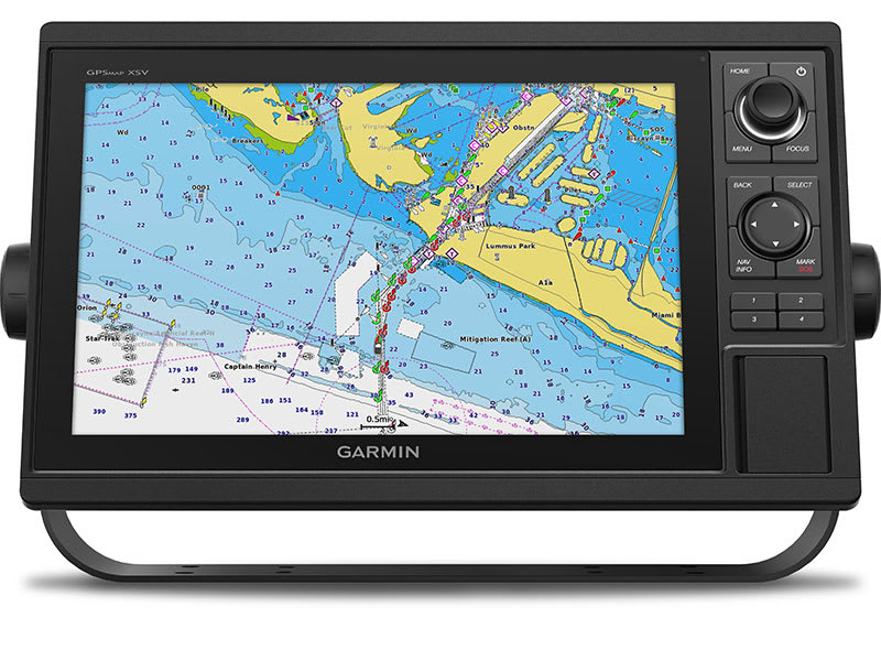
SMOOTH TRACKING
The fast and responsive built-in 10Hz GPS and GLONASS receiver refreshes your location and direction of travel 10 times per second for smoother movement on the display.
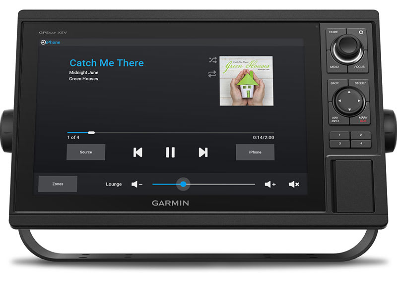
NETWORK SUPPORT
GPSMAP chartplotters are fully compatible with Garmin Marine Network and NMEA 2000® and support NMEA 0183 technology.
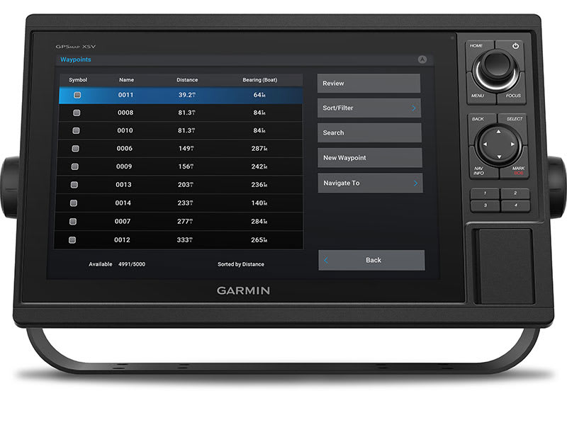
TRANSFER OF GPX WAYPOINTS
Easily transfer waypoints, passed routes or frequently used routes from other devices via the standard GPX software format.
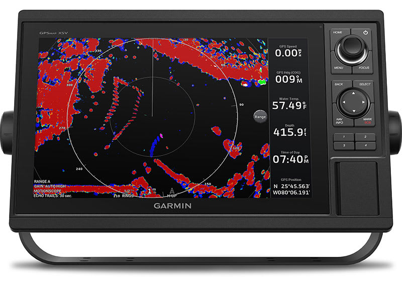
SHARING ON THE NETWORK
Garmin Marine Network support allows you to share sonar, charts, user data, indoor and outdoor radars, and Panoptix and LiveScope sonars with other units.
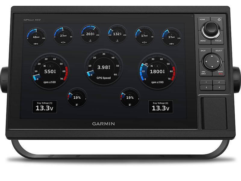
CONNECTION TO THE ENGINE
Monitor engine speed, fuel consumption, temperature, tilt and other important information. Check with the engine manufacturer for information on additional equipment needed.
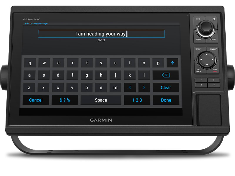
SEND INREACH® MESSAGES
Pair the inReach2 satellite communicator with the chartplotter and write messages via the on-screen keyboard on the multifunction display. Use your contact list or enter an email address, inReach address or phone number. Group messages into conversations as you are used to when texting.
| Category: | Sonars |
|---|---|
| GPS: | Yes |
| Installation options: | Bail, Flat, Flush |
| Receiver: | 10 Hz |
| Display resolution: | 22" |
Be the first who will post an article to this item!


